USLUCA Village Digital Map | Updated Neighbourhood Map
Giresun ilinde,
Çamoluk ilçesinde, köyler içinde,
En kalabalık listesinde 2. Usluca kayıtlarda ikinci sırada yer bulmuştur.
Kişi başı kazancı lider listesinde 3. Usluca istatistiklere göre üçüncülük pozisyonundadır.
Aile sayısı bakımından zirvede listesinde 2. Usluca sıralamada ikinci sırada yer almaktadır.
Yapı stoğu en yüksek listesinde 3. Usluca istatistiklere göre 3. sıradadır.
Arsa fiyatlarında lider listesinde 4. Usluca şehir içi istatistiklerde dördüncü konumdadır.
Finans erişimi en geniş olan listesinde 4. Usluca listede 4. sırada olmasıyla bilinir.
Genç–çocuk oranı zirvede listesinde 1. Usluca istatistiklere göre en üst sıradadır.
İleri yaş grubunda zirvede listesinde 2. Usluca sıralamada ikinci sırada yer almaktadır.
| Adi | USLUCA Province Affiliated | GIRESUN District Affiliated | ÇAMOLUK Postal code | 28712 Number of Streets | 1 Population Density km2-people | 11.71 Number of Apartments with business Licenses | 5 Number of Apartments with Residential Licenses | 473 Number of Households / Families | 133 Total Population | 281 Male Population | 145 Woman Population | 136 Income Per Person - Spendable TL-Month | 6.560 |
|---|
USLUCA Village Map | Satellite View and Local Boundaries
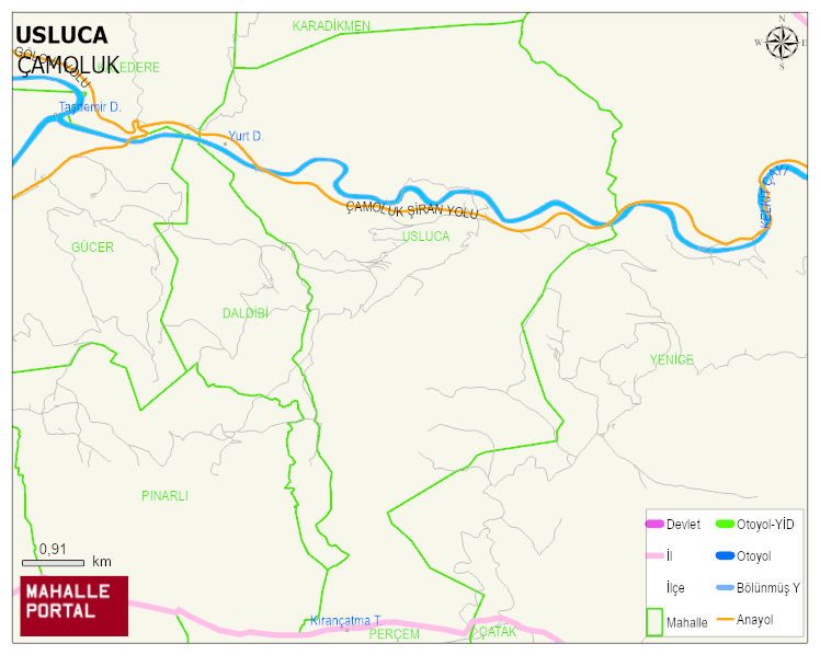
USLUCA Village Digital Map | Updated Neighbourhood Map
USLUCA Village – Population, Postal Code, Number of Workplaces
USLUCA village ÇAMOLUK district of GIRESUN province. UAVT (National Address Database Code) Village Code: 14513. Postal Code: 28712. USLUCA 1 streets and avenues, 5 independent business licensed apartments, 472 residential licensed apartments, 141 households. 325 people live in this settlement. 176 male, 149 female. 60 and over is 154. The population rate of 60+ people is % 47 ÇAMOLUK -in the district- 7. the most crowded neighbourhood.
Leave a Comment