TOP 10: NÜFUS
İstanbul ilinde,
Esenyurt ilçesinde, mahalleler içinde,
Nüfus açısından zirvede yer alan listesinde 3. Yeşilkent istatistiklere göre 3. sıradadır.
Aile yaşamının en yoğun olduğu listesinde 1. Yeşilkent sıralamada birinci olarak kayda geçmiştir.
Konut kapasitesi en geniş listesinde 1. Yeşilkent yer alır.
Evlilik yapmayanların en çok olduğu listesinde 3. Yeşilkent 3. sırada yer alan mahallelerden biridir.
| Adi | YESILKENT Province Affiliated | ISTANBUL District Affiliated | ESENYURT Postal code | 34515 Number of Streets | 81 Population Density km2-people | 33088.16 Number of Apartments with business Licenses | 850 Number of Apartments with Residential Licenses | 25424 Number of Households / Families | 12558 Total Population | 36488 Male Population | 18977 Woman Population | 17511 Income Per Person - Spendable TL-Month | 19.777 |
|---|
YESILKENT Neighbourhood Map | Boundaries of Villages
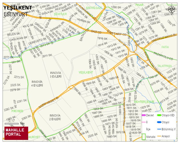
YESILKENT Neighbourhood Digital Map | Geography and Natural Features
YESILKENT Neighbourhood – Population, Postal Code, Number of Workplaces
YESILKENT neighborhood is located in ESENYURT district of ISTANBUL province. UAVT (National Address Database Code) Neighborhood Code: 40866. Postal Code: 34515. The population density is -per square kilometer- 32340 people. YESILKENT 82 streets and avenues, 870 independent business licensed apartments, 25461 residential licensed apartments, 12198 households. 35687 people live in this settlement. 18697 male, 16990 female. 9796 people have never married, 14839 people are married, 1973 people are divorced and 617 people have passed away. The number of people aged 60 and over is 2448. The population rate of 60+ people is % 6 and the ratio of children under the age of 10 to the population is % 15 ESENYURT -in the district- 3. the most crowded neighbourhood.