YUKARIBARAKLI Village Digital Map | Updated Neighbourhood Map
Amasya ilinde, köyler içinde,
65+ nüfusu en yoğun olan listesinde 3. Yukarıbaraklı zirveye oynayan yerleşimlerden biri.
Taşova ilçesinde, köyler içinde,
Okuryazarlık oranı sınırlı listesinde 3. Yukarıbaraklı üçüncü konumda bulunan mahalledir.
Dul oranı zirvede listesinde 5. Yukarıbaraklı listede beşinci sırada yer almaktadır.
65+ nüfusu en yoğun olan listesinde 3. Yukarıbaraklı şehir içi sıralamada 3. sıradadır.
| Adi | YUKARIBARAKLI Province Affiliated | AMASYA District Affiliated | TASOVA Postal code | 05802 Number of Streets | 9 Population Density km2-people | 16.73 Number of Apartments with business Licenses | 19 Number of Apartments with Residential Licenses | 390 Number of Households / Families | 206 Total Population | 439 Male Population | 207 Woman Population | 232 Income Per Person - Spendable TL-Month | 5.954 |
|---|
YUKARIBARAKLI Village Map | Mountains, Rivers and Elevation Details
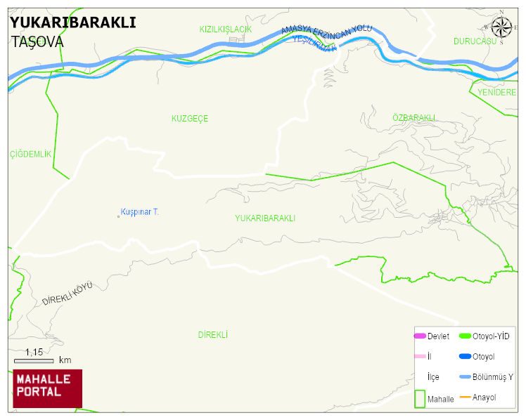
YUKARIBARAKLI Village Digital Map | Updated Neighbourhood Map
YUKARIBARAKLI Village – Population, Postal Code, Number of Workplaces
YUKARIBARAKLI village TASOVA district of AMASYA province. UAVT (National Address Database Code) Village Code: 49342. Postal Code: 5802. YUKARIBARAKLI 9 streets and avenues, 19 independent business licensed apartments, 393 residential licensed apartments, 204 households. 464 people live in this settlement. 220 male, 244 female. 60 and over is 264. The population rate of 60+ people is % 56 En yasli 600 mahalle ve köyden biridir. (Nüfusu 250den büyük 29000 köy ve mahalle içinde)
Leave a Comment