YUKARIKOLBASI Village Digital Map | Boundaries of Villages
Bitlis ilinde, köyler içinde,
Rayiç bedeli zirvede listesinde 4. Yukarıkolbaşı tepedeki dört isimden biri.
Güroymak ilçesinde, köyler içinde,
En fazla nüfus barındıran listesinde 5. Yukarıkolbaşı istatistiklere göre ilk beş içinde, 5. sıradadır.
Maddi refahı zirvede olan listesinde 5. Yukarıkolbaşı kayıtlarda 5. sırada gözükmektedir.
En çok çocuklu ailelerin yaşadığı listesinde 4. Yukarıkolbaşı kayıtlarda dördüncü basamakta gözükür.
| Adi | YUKARIKOLBASI Province Affiliated | BITLIS District Affiliated | GÜROYMAK Postal code | 13802 Number of Streets | 1 Population Density km2-people | 79.39 Number of Apartments with business Licenses | 0 Number of Apartments with Residential Licenses | 116 Number of Households / Families | 100 Total Population | 527 Male Population | 274 Woman Population | 253 Income Per Person - Spendable TL-Month | 5.068 |
|---|
YUKARIKOLBASI Village Map | Terrain and Topography
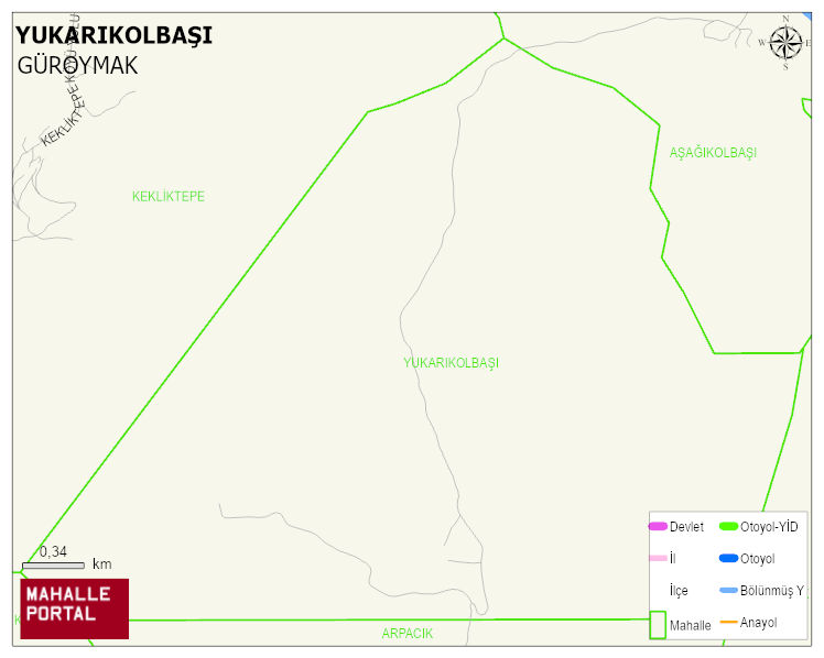
YUKARIKOLBASI Village Digital Map | Boundaries of Villages
YUKARIKOLBASI Village – Population, Postal Code, Number of Workplaces
YUKARIKOLBASI village GÜROYMAK district of BITLIS province. UAVT (National Address Database Code) Village Code: 6362. Postal Code: 13802. YUKARIKOLBASI 1 streets and avenues, 116 residential licensed apartments, 103 households. 533 people live in this settlement. 284 male, 249 female. 60 and over is 29. The population rate of 60+ people is % 5 and the ratio of children under the age of 10 to the population is % 25
Leave a Comment