TOP 10: NÜFUS
İstanbul ilinde,
Bakırköy ilçesinde, mahalleler içinde,
Ticari hayatın en yoğun olduğu listesinde 2. Zeytinlik 2. sırada olmasıyla dikkat çeker.
Finans erişimi en geniş olan listesinde 5. Zeytinlik istatistiklere göre 5. sıradadır.
Yalnız yaşayanların en fazla bulunduğu listesinde 3. Zeytinlik listede üçüncü basamakta konumlanmıştır.
İleri yaş grubunda zirvede listesinde 4. Zeytinlik kayıtlarda dördüncü basamakta gözükmektedir.
| Adi | ZEYTINLIK Province Affiliated | ISTANBUL District Affiliated | BAKIRKÖY Postal code | 34140 Number of Streets | 28 Population Density km2-people | 17563.23 Number of Apartments with business Licenses | 3002 Number of Apartments with Residential Licenses | 2881 Number of Households / Families | 2148 Total Population | 5097 Male Population | 2422 Woman Population | 2675 Income Per Person - Spendable TL-Month | 45.542 |
|---|
ZEYTINLIK Neighbourhood Map | Geography and Natural Features
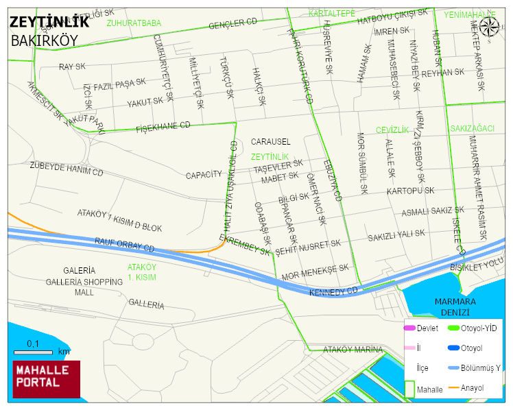
ZEYTINLIK Neighbourhood Digital Map | All Neighbourhoods and Settlements
ZEYTINLIK Neighbourhood – Population, Postal Code, Number of Workplaces
ZEYTINLIK neighborhood is located in BAKIRKÖY district of ISTANBUL province. UAVT (National Address Database Code) Neighborhood Code: 40193. Postal Code: 34140. The population density is -per square kilometer- 17721 people. ZEYTINLIK 28 streets and avenues, 3000 independent business licensed apartments, 2875 residential licensed apartments, 2158 households. 5146 people live in this settlement. 2440 male, 2706 female. 1551 people have never married, 2115 people are married, 547 people are divorced and 389 people have passed away. The number of people aged 60 and over is 1299. The population rate of 60+ people is % 25 and the ratio of children under the age of 10 to the population is % 6