TOP 10: NÜFUS
İstanbul ilinde,
Kadıköy ilçesinde, mahalleler içinde,
Nüfus sıralamasında 2. Kozyatağı 2. sırada, bölgenin önde gelen yerleşimlerinden biridir.
Aile büyüklüğü sıralamasında 2. Kozyatağı 2. sırada kayıtlı, önemli bir yerleşimdir.
Mesken sayısı sıralamasında 3. Kozyatağı sıralamada üçüncü sırada yer almaktadır.
Ticari yoğunluk sıralamasında 5. Kozyatağı istatistik listelerinde beşinci sırada yer alır.
Banka ATM'lerine ilişkin sıralamada 4. Kozyatağı kayıtlarda 4. sırada yer almaktadır.
| Adi | KOZYATAGI Province Affiliated | ISTANBUL District Affiliated | KADIKÖY Postal code | 34742 Number of Streets | 63 Population Density km2-people | 25621.77 Number of Apartments with business Licenses | 2169 Number of Apartments with Residential Licenses | 18847 Number of Households / Families | 15039 Total Population | 36873 Male Population | 16296 Woman Population | 20577 Income Per Person - Spendable TL-Month | 51.032 |
|---|
KOZYATAGI Neighbourhood Map | Updated Neighbourhood Map
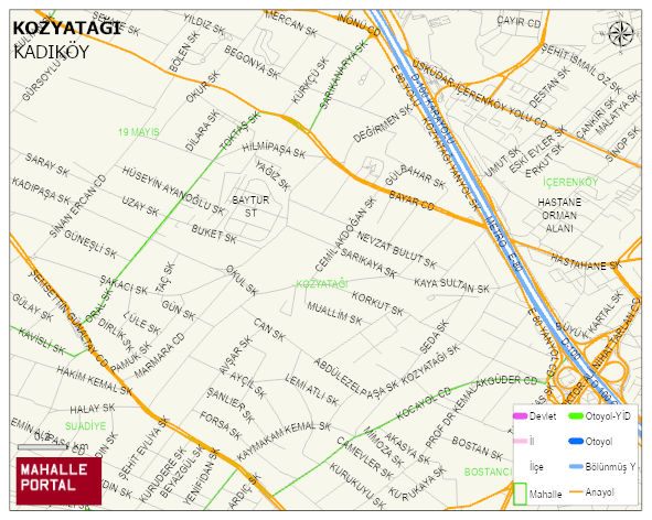
KOZYATAGI Neighbourhood Digital Map | Satellite View and Local Boundaries
KOZYATAGI Neighbourhood – Population, Postal Code, Number of Workplaces
KOZYATAGI neighborhood is located in KADIKÖY district of ISTANBUL province. UAVT (National Address Database Code) Neighborhood Code: 40529. Postal Code: 34742. The population density is -per square kilometer- 25781 people. KOZYATAGI 63 streets and avenues, 2251 independent business licensed apartments, 18798 residential licensed apartments, 15219 households. 37125 people live in this settlement. 16403 male, 20722 female. 8600 people have never married, 18360 people are married, 3045 people are divorced and 2650 people have passed away. The number of people aged 60 and over is 9783. The population rate of 60+ people is % 26 and the ratio of children under the age of 10 to the population is % 7 KADIKÖY -in the district- 2. the most crowded neighbourhood.