TOP 10: NÜFUS
İstanbul ilinde,
Kartal ilçesinde, mahalleler içinde,
Nüfus sıralamasında 2. Uğur Mumcu ikinci sırada yer almaktadır.
Gelir düzeyi sıralamasında 3. Uğur Mumcu istatistik listelerinde 3. sırada yer almaktadır.
Aile büyüklüğü sıralamasında 2. Uğur Mumcu istatistiklere göre ikincilik pozisyonundadır.
Mesken sayısı sıralamasında 3. Uğur Mumcu sıralamada üçüncü sırada yer almaktadır.
Üniversite mezuniyeti oranı sıralamasında 4. Uğur Mumcu yer alır.
| Adi | UGUR MUMCU Province Affiliated | ISTANBUL District Affiliated | KARTAL Postal code | 34882 Number of Streets | 53 Population Density km2-people | 22810.64 Number of Apartments with business Licenses | 476 Number of Apartments with Residential Licenses | 15489 Number of Households / Families | 13526 Total Population | 40138 Male Population | 19267 Woman Population | 20871 Income Per Person - Spendable TL-Month | 36.159 |
|---|
UGUR MUMCU Neighbourhood Map | Boundaries of Villages
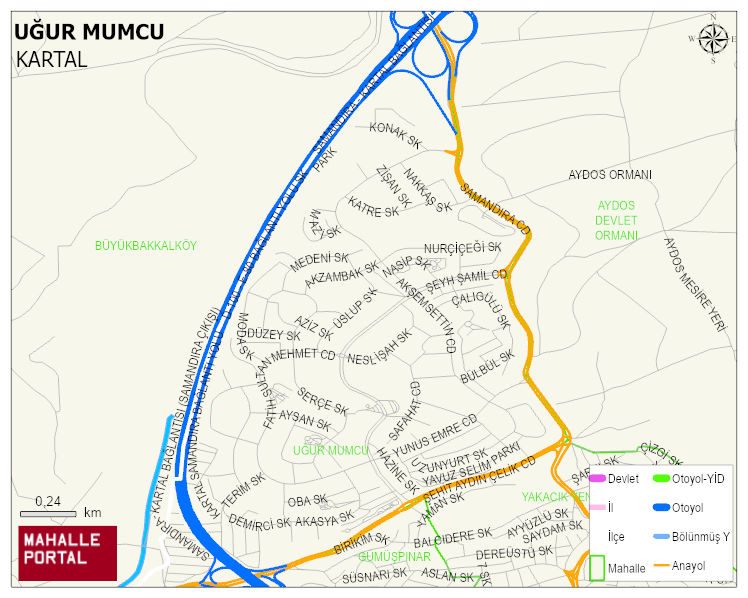
UGUR MUMCU Neighbourhood Digital Map | Updated Neighbourhood Map
UGUR MUMCU Neighbourhood – Population, Postal Code, Number of Workplaces
UGUR MUMCU neighborhood is located in KARTAL district of ISTANBUL province. UAVT (National Address Database Code) Neighborhood Code: 40569. Postal Code: 34882. The population density is -per square kilometer- 22866 people. UGUR MUMCU 53 streets and avenues, 474 independent business licensed apartments, 15396 residential licensed apartments, 13525 households. 40257 people live in this settlement. 19340 male, 20917 female. 9039 people have never married, 19631 people are married, 2574 people are divorced and 1843 people have passed away. The number of people aged 60 and over is 6865. The population rate of 60+ people is % 17 and the ratio of children under the age of 10 to the population is % 11 KARTAL -in the district- 2. the most crowded neighbourhood.