YONGALIK Village Digital Map | All Neighbourhoods and Settlements
Düzce ilinde,
Gümüşova ilçesinde, köyler içinde,
En fazla yüksek gelirli yaşayan listesinde 4. Yongalık sıralamada dördüncü sıradadır.
Yalnız yaşayanların en fazla bulunduğu listesinde 5. Yongalık sıralamada beşinci sırada yer almaktadır.
Eşi vefat edenlerin en yoğun olduğu listesinde 3. Yongalık üçüncü konumda bulunan mahalledir.
İleri yaş grubunda zirvede listesinde 5. Yongalık 5. sırada kayıtlı ve dikkat çeken bir yerleşimdir.
| Adi | YONGALIK Province Affiliated | DÜZCE District Affiliated | GÜMÜSOVA Postal code | 81852 Number of Streets | 1 Population Density km2-people | 41.11 Number of Apartments with business Licenses | 1 Number of Apartments with Residential Licenses | 169 Number of Households / Families | 93 Total Population | 264 Male Population | 131 Woman Population | 133 Income Per Person - Spendable TL-Month | 6.401 |
|---|
YONGALIK Village Map | Mountains, Rivers and Elevation Details
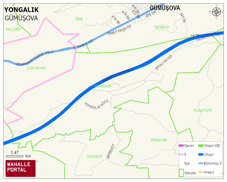
YONGALIK Village Digital Map | All Neighbourhoods and Settlements
YONGALIK Village – Population, Postal Code, Number of Workplaces
YONGALIK village GÜMÜSOVA district of DÜZCE province. UAVT (National Address Database Code) Village Code: 37583. Postal Code: 81852. YONGALIK 1 streets and avenues, 1 independent business licensed apartments, 166 residential licensed apartments, 93 households. 258 people live in this settlement. 127 male, 131 female. 60 and over is 74. The population rate of 60+ people is % 28
Leave a Comment